27.6.16

Kanangra to Katoomba


1 day / 46km / 2500vm

Originally schemed as a return walk over 2 days ­(KKK; mainly to avoid a lengthy car shuffle), it panned out that we’d settle for just the first day.

The drive up from Canberra, via Goulburn and Oberon, was a fun one. A 2am departure meant deserted roads the whole way. I hit snow just after crossing the Abercrombie River, and had to slow it down slightly as it got thicker nearing Black Springs. The snow continued the whole way through to Kanangra Walls car park, and I even had some ~40cm snow drifts over the road past Oberon.


I pulled in to the car park at 615 and Cam and Scott arrived about 7. We were off and walking by about 7am but the pace was very slow at first with a hard layer of ice coating the rocky plateau. After descending off the plateau a normal walking pace was possible, but we still had a few inches of snow under foot.

Ice on the plateau. Cam's photo
Our human compass, Scott, made navigation unnecessary, and to be honest the faint foot pad was pretty easy to follow / guess where it should be heading. We crested the Cloudmaker and descended down to Cox’s River for a quick lunch. After the river crossing the track was well defined and easy walking all the way to the end.
Snow underfoot. Cam's photo
Dusk fell around the time we got to the camping cave at Mobbs Swamp, and half an hour later we were walking by headlight. Up the ladder at Narrowneck and along the fire trail for the final 10km, we finished at the car about 9pm.
Nearing the end. Cam's photo
An awesome walk with great company, on a clear cold day (~0deg morning and night with a cold westerly on the ridges).
Kanangra Walls. Cam's pano

25.9.15

7 days to walk the Larapinta


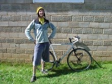
A last minute flurry of decisions, organising, and purchasing saw Cam and I flying up to Alice Springs with a 7 day window to walk the 220km from Redbank Gorge back in to Alice Springs. 

A few big stars had aligned to make this trip happen, namely me managing to get leave from work at short notice, Po’s mum being in town to bravely take up child-minding of the twins, and Po’s dad still being in Alice and free to help us out with transport and a food drop. A week before leaving I had suggested the Larapinta to Cam, and that was that – the plan was formed. 

We had to cover some distance so it was fast and light in terms of gear and food. Freeze-dried dinners made up all our dinners, and our gear selection kept our pack weights (dry) down at around 10kg. We had 6L of water carrying capacity anticipating some fairly warm (~31deg) weather and dry camps. 

Thursday the 10th we found each other in the airport in Sydney and boarded our final flight to the Red Centre. Dave met us at the airport and after a little running around town for lunch, water and a replacement waist buckle, we were pootling down Namatjira Drive with the West MacDonnells shadowing us on our right. We had a quick repack at Redbank Gorge, agreed with Dave on a food drop time/place, and were off walking by about 530pm. 

Day 0 / 11.8km

We walked a quick 12km in the cool of the evening, and lay out our bags at Rocky Gap for our coldest night of the trip – dipping to about 3deg pre-dawn.

Day 1 / 38.6km

The next day was one of two longest days – almost 40km saw us climb over Hilltop Lookout, pass through Finke River and get to Ormiston Gorge for lunch. After a good break, but with no sign of the afternoon cooling off, we continued on, cresting Heavitree Range on dusk. Head torches on, we lay out the tarp for the night at Waterfall Gorge.

Day 2 / 26.7km

Our second full day saw us walking the rest of the beautiful valleys of Heavitree to Serpentine Chalet Dam. It was a hot day so the lure of a swim in the dam at lunch was our carrot. Now while not technically incorrect – there indeed was a dam – it was more akin to a cold scummy pool populated with scorpion schwanger-bugs. But a swim is a swim. A few more kms saw us pass Counts Point and finish the day for a proper swim at Serpentine Gorge. This ended up being our only night sleeping on one of the 4 new trail shelter platforms, shared with a nice couple from Scotland and some characters from Melbourne.

Day 3 / 29.1km

Another hot day was forecast so we got an early start and made Ellery Creek by about 10. It was an easy decision to while away the hot hours of the day here – swimming, reading, and chatting to the tourists who endlessly walked down to photograph the beautiful waterhole. We met some nice people (a young couple who gifted us some fresh snow peas) and some dickheads (a guy with a drone, and a drum-and-bass loving git): fun for all! Once the day showed signs of cooling down, we were on our way to Rocky Gully, 6 hours after arriving at Ellery.

Day 4 / 15.9km

We only had a short distance on flat terrain before our rendezvous with Dave and the food drop, but faced with another hot day we got going at our usual time. We made Hugh Gorge by about 10am and after some wishful searching for a shady waterhole in which to set up in, we settled for the small rectangular patch of shade under the information sign. Luckily Dave had been watching our Spot progress so we only waited 30 minutes before the low drone of the 4wd could be heard in the distance.

Day 5 / 23.7km

The sections between Hugh Gorge and Standley Chasm rated pretty highly for us – rocky bluffs, tight gorges, broad valleys, steep climbing and rocky descending. Very enjoyable walking which made the day tick by quickly. We had a great lunchtime siesta under the shade of a large Ghost Gum at Birthday Waterhole, and managed to time the end the day perfectly, summiting Brinkley Bluff right on sunset. With good phone reception we called home and got the exciting news that Abbott had been ousted. Winner!

Day 6 / 35.4km

We ‘woke’ after a pretty sleepless night atop Brinkleys, having been buffeted from all directions throughout the night. Never-the-less, we were treated to a stunning sunrise as we descended in the cool wind. At Standley Chasm we treated ourselves to coffee, cake and takeaway lasagne, but didn’t rest too long as we’d now decided to make Alice by the 17th. We ate the lasagne at Jay Creek and finished the day in the dark at a nice flat spot a km or so past Mulga Camp.

Day 7 / 37.1km

Only 37km to go! It was fairly basic walking to Telegraph Station, made interesting by the very cool Euro Ridge. We motored this bit and made the finish by about 430pm, making the time cut for a 7 day walk;)

All up it was a comfortable walk. The weather (day time temps ranged from mid 20’s to max 37degC) largely determined our walking hours – most days enforcing a long midday siesta, so the books and music Cam brought were a great move! The tank water located at the trail heads was reliable and clean. Most times we were only carrying 2L each, but the most we carried was 5L each for the dry camp on Brinkleys. We took a S2S tarp which can pitch as a fly using Cam's walking poles, but we only ever used it as a ground sheet. We burned through about 1 and a third Jetboil cannisters, boiling water for dinners and hot drinks. Lastly, the long pants, long shirts and window licker hats were essential!


4.1.13

Xmas 2012: 9 days of riding through KNP

Xmas this year was a Sutton-family affair and also a bit of a dream of mine: a supported ride. 7 people, 5 bikes and 2 cars meant that everyday there'd be people driving to ferry the camping gear to the next night's camp. I'd worked out an itinerary beforehand which mixed up some varied and interesting rides, short drives and simple logistics.. and it all started with Po and myself riding from Lyneham..

Day 1: Lyneham to Blue Waterholes 112km / 2330vm

Originally we'd planned to take 2 days to get to Blue Waterholes, but as Xmas shopping and packing always takes 5 times as long as you'd think, we decided to minimise the stress, leave a day later and get the ride done in a day. This meant we had to do the sneaky and cut through the Bimberi Wilderness area on our bikes. Despite the bullshit which is Murray's Gap FT, the day was awesome, although very hot (nudging 40 degrees on the Garmin).
Po thinking about braving the Coldblue Waterholes
From Canberra we zipped down along the bikes paths to the edge of Banks, and then on the road down to Orroral Valley, with only minor stoppage for a play on the flying fox in Kambah and a swim in Orroral River. It was nice pedalling through Orroral Valley and over past Cotter Hut. It was not nice up, over and down Murray's Gap, but I've already mentioned that:) Arriving at Blue Waterholes campground we met the others and were rewarded with a cool thunderstorm which cleaned the air.

Day 2: Blue Waterholes to Kiandra 60km / 1000vm

For the ride to Kiandra we were joined by Gail and Graeme. The day started out easy enough with a nice cruise along Pockets Saddle FT and Tantangara Rd past Tantangara Dam. On the map theres a straight looking FT that appears to neatly join Tantangara Rd to Kiandra, so it was logical to give it a bash. Turning off the all-too-smooth and obvious road was where things got a bit interesting.

Progress slowed to quite slow with a pretty faint track across a grassy plain for a few kms, before picking up the better looking Nungar Creek FT. That's about when the heavens decided to open and tried to make us shit our pants from lightening-induced fear. We arrived at Wolgals Lodge in Kiandra soaked, muddy and with a few lightening-singe hairs. The next day was Xmas day and a rest day so all we had to do was eat like our lives depended on it, and play scrabble.

Day 4: Kiandra to Bradley's Hut 60km / 1000vm

Po and a tree near Bradley's Hut
Graeme with that 6-fish-in-a-day swagger
Po and I were joined by Cec for this beautiful little coffee-interupted cruise down past Selwyn and Cabramurra (3 flatwhites thanks), to Bradley's Hut. Riding down, over and back up from Tumut Pond was easily the highlight. I couldn't quite believe I'd never seen this stunning little dam before. Although Bradley's Hut is right next to the road, we had the whole place to ourselves and it proved to be a fantastic place to while-away an afternoon.


Day 5: Bradley's Hut to Island Bend 63km / 1400vm

In my mind, this ride is an essential outing for everyone who rides mountain bikes. Starting from Bradley's Hut we rode the length of Round Mountain FT past Derschkos Hut, turned on to Grey Mare FT to Grey Mare Hut, and then finally on to Valentine FT past Valentines Hut to Schlink Pass Rd. From the pass itself it's a quick blast downhill to Munyang and then on to our winter home, Island Bend. Dave joined us for this awesome day on the bikes and everyone else drove (the longest transfer day) - so to them I say thankyou!

Day 6: Island Bend to Geehi Flats 69km / 1400vm

Team Ride365 representing in the river with ciders

This ride was Gail's suggestion and was promised to us as 40km of downhill. Hard to say no to that! To get to the downhill we first had to climb back up to Munyang, and then up to Schlink Pass at 1804m. From there it was largely downhill all the way to Geehi Flats at about 440m. There were a few little ups in there towards the end (at around about Geehi Reservoir), but we were distracted by stunning views of the Western Faces which kept the smiles on our faces. Gail and Graeme were straight in to the Geehi River with full kit and ciders, and Po and Soph weren't too far behind.

Geehi Flats campfire by the river

Day 7: Geehi Flats to Ngarigo 54km / 1700vm

The kids rode yesterday, so it was Dave and Cec's turn today.. and me: a straight forward rode cruise up to DHG and down to Ngarigo. Funnily enough I'd never done this ride before so I was happy to get in to a rhythm and punch out a truly great climb (albeit on the 29er so I'll have to come back with the roadie soon). Blessed with another amazing river to camp beside, it was swims for all once again. Day 8 would largely be a rest day in Thredbo, with a bit of singletrack exploration on the side.

Bugger carrying all your gear - chuck 'im in a ute!

Day 9: Jindy 8hr or "Race to Lose"

The last riding day would be a pretty social one with the Jindy 8hr. Strange rules meant you could have all riders in the same team on course at the same time, so, as you'd expect from sweet trails, it turned out we pretty well did. The only catch being that we had 7 riders in a 4 person team (and riding on 4 bikes) so we couldn't actually do well as we were sure some people may have gotten uppity had we beaten them (as some racers tend to do these days). All was going well, we were each chucking the odd lap, having fun on the trails, until a casual check of the results at the 4hr mark - we had a 2 lap advantage over the team in second place. Damn. Time to bring out the strategies to lose. Well it turned out to be a pretty basic strategy: have a shower, have a nice lunch, go in to Jindy for iceblocks, etc etc.. Did it work? Yep, we smashed it and didn't place. Winners!


19.11.12

Brindies Circ: Day 2

Day 2: 135km / ?vm

Mt Bimberi didn't want to get out of bed in the morning
After a mild night the day dawned with a low cover of cloud, and after breakfasting and packing up we were off along Lone Pine FT by 7am. 
Lone Pine FT
The condition of this trail wasn't the best, and I think we were all fearing a similar slog to yesterday, so it was heads down while we ticked off the next 10 or so kms.
Lone Pine FT
Topping out on Lone Pine we could see our future far, far below us - the Yaouk Valley. A huge, broad, flat valley, which would take us to familiar ground and the road home. The descent was steep and fast, and that was with both brakes fully on.
The end of the descent down Lone Pine FT in to the valley

Flat roads! Kennedys Rd
Arriving down in the valley we were blessed with a light tail wind to help us tick over the kms just that little bit faster. It was amazing riding through here with the Scabby Range on our left, Yaouk Peak on our right, and flat grassy plains and the odd squiggly river stretched out around us.
Turning on to Yaouk Rd

Yaouk Valley
Soon enough we'd made it to Shannons Flat, turned left and ridden back in to the ACT. We left the Bogan Hwy on to the quieter Old Boboyan Rd and had lunch at a ruin. The remainder of the ride was pretty cruisy: we got rained/hailed on briefly before making it to Yankee Hat car park, and ticked off the kms on the tar back to Namadgi Visitors Centre in a swirling wind. Monty and Steve were getting a lift from Tharwa so I jumped back on the road and tapped it out back home to Lyneham.
The end of Old Boboyan Rd at Yankee Hat carpark

Brindies Circ: Day 1

Day 1: 123km / 3390vm

I was lucky to find participants for this ride as most were either on the 3Fidi ride or otherwise previously engaged, however Monty and Steve were keen. The plan was for the Brindabella Circuit Beth suggested (and Martin recently soloed in a day), however in reverse and overnighting at Oldfields Hut.

7am Saturday I left home riding with Po, and then Pat out toward Piccadilly Circus. Monty and Steve were getting dropped off there at 9, however as luck would have it I was running late, and they were running early, so they caught me at Uriarra Homestead and treated me with a lift the rest of the way. All together now, we started the ride with the descent down in to the Brindabella Valley.
The descent from Piccadilly Circus in to Brindabella Valley
After crossing the Goodradigbee River it was only 11kms further along Brindabella Road until we turned off on to Boundary Road and left the good roads behind. The climbs along Boundary, Powerline and Bramina Roads were steep and rocky, and so were the descents, so it was pretty slow going.
Powerline Road
Turning on to Broken Cart Fire Trail things began to improve with slightly smoother roads, beautiful little valleys and our first pack of Brumbies.
Refilling at a creek on Broken Cart FT

Brumbies on Broken Cart FT
Gradually though, the valleys became broader, and it wasn't long before we rode down Long Plain Rd on to the vast Cooleman Plains. A few quick km's later and we were pulled in to the Blue Waterholes campground for a breather.
Long Plain Rd
The trail between Blue Waterholes and Pockets Hut was pretty overgrown and grassy, but easy to follow and surprisingly comfortable after all the rocky stuff we'd dealt with earlier in the day.
Monty crossing a creek near Blue Waterholes
The best sites for overnighting along this ride are concentrated within about a 10km stretch. Starting with 2 great options at Blue Waterholes, there's Pockets Hut and then finally Oldfields Hut. We pressed on to the latter so it meant one last hill to climb.
Brumbies on Blue Waterholes FT
Luckily, we had Oldfields all to ourselves. With its fireplace, watertank, pit toilet, lush grass and magic view, it was an awesome spot to stay.
Oldfields Hut
Totals for the day:
Jarrad 123km / 3390vm (141km if I hadn't taken the lift)
Monty & Steve 85km(?)
Sunset over Mt Bimberi